
Published on 2020/11/27
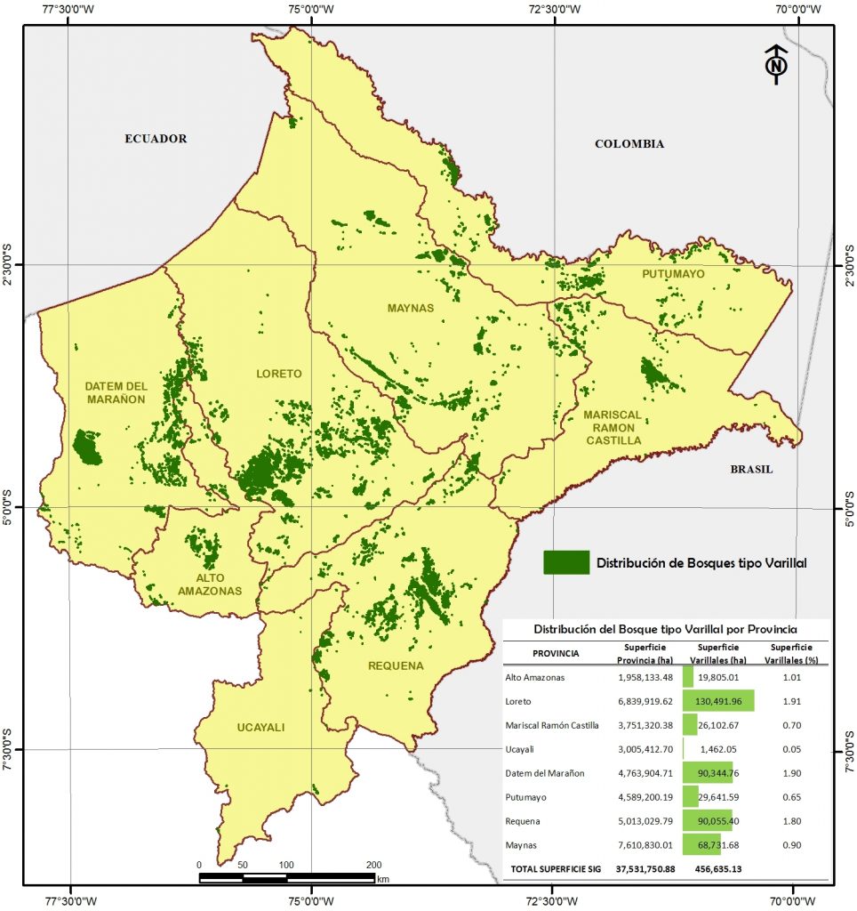
Iquitos. As a result of the arduous research work of the Executive Directorate of Conservation and Biological Diversity (DECDB) of the Regional Environmental Authority (ARA) of the Regional Government of Loreto and the technical support of the Center for the Development of the Amazonian Indigenous (CEDIA) and the Research Institute of the Peruvian Amazon (IIAP), was presented "Map and Descriptive Memory of the Varillales of the department of Loreto - Peru" that seeks to contribute to the process of territorial ordering of the region for a sustainable management of natural resources and conservation of varillal-type forests, a fragile ecosystem that harbors a diversity of plant species, many of them endemic and threatened

The Varillales Map of the department of Loreto was approved by Regional Ordinance No. 031-2018-GRL-CR. The publication was possible from the integration of remote sensing techniques with geographic information systems, as well as field work.
This publication is an important source of cartographic information for decision-making on the conservation of varillales in the department of Loreto, which will be of great use for future efforts and research.

Fact
The varillales cover an approximate surface of 457 439.69 ha in the Loreto region and are widely distributed in the department of Loreto and their presence is recorded in all its provinces. One of the results of the investigation indicates that the Priority Sites for Conservation are home to almost half of the varillales found in the department of Loreto (233 509 ha, corresponding to a 51%), which indicates the need to promote the conservation of such sites.
1 Comment
.